
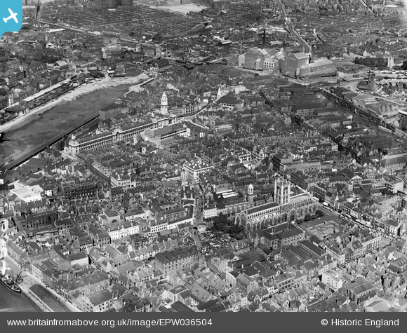
EPW036504 ENGLAND (1931). The Market Place, Holy Trinity Church and environs, Kingston upon Hull, 1931
© Copyright OpenStreetMap contributors and licensed by the OpenStreetMap Foundation. 2024. Cartography is licensed as CC BY-SA.
Nearby Images (11)
EPW036504

EPW036506

EPW012813

EPW010789

EPW036503

EPW010792

EAW046135

EAW015657

EAW015638

EAW015644

EAW046134

Details
| Title | [EPW036504] The Market Place, Holy Trinity Church and environs, Kingston upon Hull, 1931 |
| Reference | EPW036504 |
| Date | August-1931 |
| Link | |
| Place name | KINGSTON UPON HULL |
| Parish | |
| District | |
| Country | ENGLAND |
| Easting / Northing | 509987, 428700 |
| Longitude / Latitude | -0.33210809547482, 53.742838721587 |
| National Grid Reference | TA100287 |
Pins
 Daniel |
Sunday 29th of November 2015 02:39:53 PM | |
John Wass |
Monday 5th of January 2015 02:58:28 PM | |
John Wass |
Friday 14th of November 2014 04:10:48 PM | |
John Wass |
Friday 14th of November 2014 04:09:26 PM | |
John Wass |
Wednesday 27th of August 2014 03:05:36 PM |


