
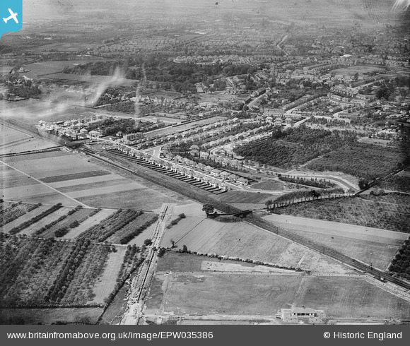
EPW035386 ENGLAND (1931). Housing at Whitton and environs, Whitton, 1931
© Copyright OpenStreetMap contributors and licensed by the OpenStreetMap Foundation. 2024. Cartography is licensed as CC BY-SA.
Nearby Images (9)
EPW035386

EPW035380

EPW035388

EPW035391

EPW035383

EPW035384

EPW035390

EPW035382

EPW035385

Details
| Title | [EPW035386] Housing at Whitton and environs, Whitton, 1931 |
| Reference | EPW035386 |
| Date | 27-May-1931 |
| Link | |
| Place name | WHITTON |
| Parish | |
| District | |
| Country | ENGLAND |
| Easting / Northing | 514424, 173621 |
| Longitude / Latitude | -0.35315217603271, 51.449509372745 |
| National Grid Reference | TQ144736 |


