
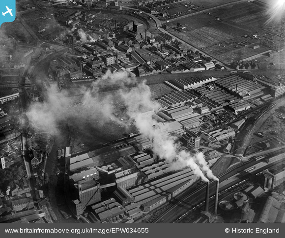
EPW034655 ENGLAND (1930). Stoneferry Canister Works and the British Extracting Works, Kingston upon Hull, 1930
© Copyright OpenStreetMap contributors and licensed by the OpenStreetMap Foundation. 2024. Cartography is licensed as CC BY-SA.
Nearby Images (26)
EPW034655

EPW047923

EPW047927

EPW034652

EPW047920

EPW036508

EPW047926

EPW047932

EPW047922

EPW047933

EPW047934

EPW047924

EPW047928

EPW047929

EPW047925

EPW034650

EPW047921

EPW047931

EPW036522

EPW047919

EPW047930

EPW036518

EPW036516

EPW034649

EPW036510

EPW036525

Details
| Title | [EPW034655] Stoneferry Canister Works and the British Extracting Works, Kingston upon Hull, 1930 |
| Reference | EPW034655 |
| Date | 16-October-1930 |
| Link | |
| Place name | KINGSTON UPON HULL |
| Parish | |
| District | |
| Country | ENGLAND |
| Easting / Northing | 510013, 430728 |
| Longitude / Latitude | -0.33099167324286, 53.761055357566 |
| National Grid Reference | TA100307 |
Pins
 John Wass |
Tuesday 4th of July 2017 03:33:31 PM | |
John Wass |
Monday 25th of May 2015 04:24:22 PM | |
 Dylan Moore |
Tuesday 11th of December 2012 03:48:24 PM |


