
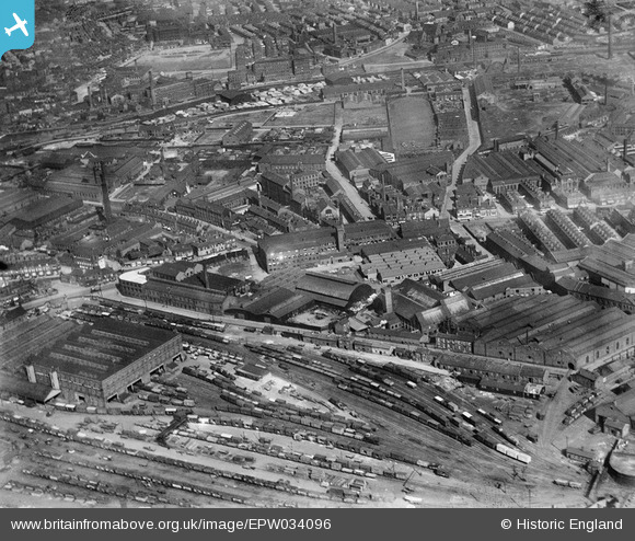
EPW034096 ENGLAND (1930). The Midland Goods Station, the Crown Point Printing Works and surroundings, Pottery Field, 1930
© Copyright OpenStreetMap contributors and licensed by the OpenStreetMap Foundation. 2024. Cartography is licensed as CC BY-SA.
Nearby Images (20)
EPW034096

EAW038458

EAW038459

EPW034098

EPW031642

EPW034099

EPW034095

EPW031644

EPW031643

EPW034097

EAW038461

EAW038455

EAW038460

EAW015962

EAW038452

EAW015960

EAW015961

EAW015963

EAW015965

EAW015966

Details
| Title | [EPW034096] The Midland Goods Station, the Crown Point Printing Works and surroundings, Pottery Field, 1930 |
| Reference | EPW034096 |
| Date | July-1930 |
| Link | |
| Place name | POTTERY FIELD |
| Parish | |
| District | |
| Country | ENGLAND |
| Easting / Northing | 430592, 432585 |
| Longitude / Latitude | -1.5356041635239, 53.788467383027 |
| National Grid Reference | SE306326 |
Pins
Be the first to add a comment to this image!


