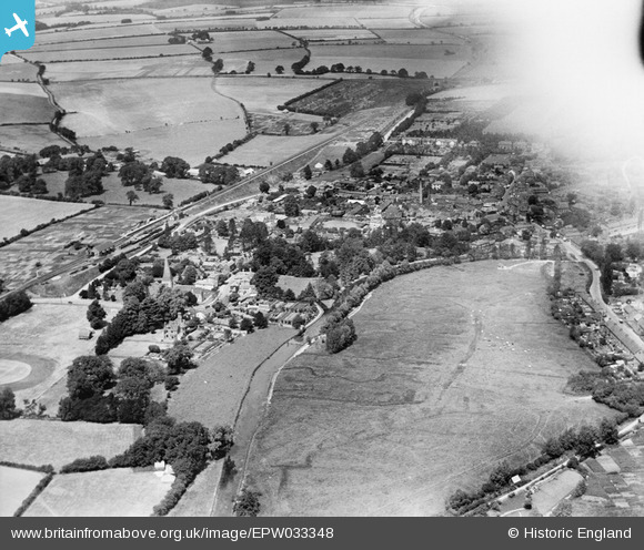
EPW033348 ENGLAND (1930). The town centre and environs, Whitchurch, 1930. This image has been affected by flare.
© Copyright OpenStreetMap contributors and licensed by the OpenStreetMap Foundation. 2024. Cartography is licensed as CC BY-SA.
Nearby Images (7)
EPW033348

EPW033350

EPW022733

EPW033346

EPW022731

EPW022729

EPW022730

Details
| Title | [EPW033348] The town centre and environs, Whitchurch, 1930. This image has been affected by flare. |
| Reference | EPW033348 |
| Date | July-1930 |
| Link | |
| Place name | WHITCHURCH |
| Parish | WHITCHURCH |
| District | |
| Country | ENGLAND |
| Easting / Northing | 446076, 147857 |
| Longitude / Latitude | -1.3400633607483, 51.227526116182 |
| National Grid Reference | SU461479 |
Pins
 Class31 |
Monday 20th of June 2016 11:11:00 PM | |
 clippedwings |
Tuesday 14th of July 2015 09:22:29 PM | |
 flubber |
Saturday 16th of March 2013 12:41:33 AM |