
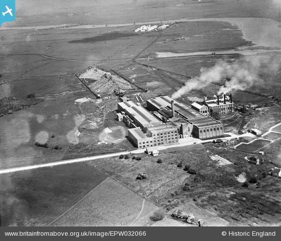
EPW032066 ENGLAND (1930). Kemsley Paper Mill, Kemsley, 1930
© Copyright OpenStreetMap contributors and licensed by the OpenStreetMap Foundation. 2024. Cartography is licensed as CC BY-SA.
Nearby Images (10)
EPW032066

EPW051141

EPW051145

EPW032068

EPW051143

EPW051146

EPW051144

EPW032090

EPW051142

EPW051147

Details
| Title | [EPW032066] Kemsley Paper Mill, Kemsley, 1930 |
| Reference | EPW032066 |
| Date | May-1930 |
| Link | |
| Place name | KEMSLEY |
| Parish | |
| District | |
| Country | ENGLAND |
| Easting / Northing | 591818, 166358 |
| Longitude / Latitude | 0.7557068883064, 51.363348691762 |
| National Grid Reference | TQ918664 |
Pins
 MPMunro |
Thursday 23rd of April 2015 12:53:20 PM |
User Comment Contributions
 Now, 2014, the largest recycled fibre mill in Europe. |
Chris |
Wednesday 24th of December 2014 05:37:29 PM |


