
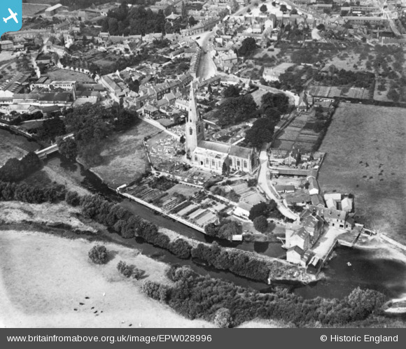
EPW028996 ENGLAND (1929). St Peter & St Paul's Church, Olney, 1929. This image has been produced from a copy-negative.
© Copyright OpenStreetMap contributors and licensed by the OpenStreetMap Foundation. 2024. Cartography is licensed as CC BY-SA.
Nearby Images (9)
EPW028996

EPW034324

EPW028994

EPW034325

EPW034449

EAW034575

EAW034574

EAW034576

EAW037768

Details
| Title | [EPW028996] St Peter & St Paul's Church, Olney, 1929. This image has been produced from a copy-negative. |
| Reference | EPW028996 |
| Date | 6-September-1929 |
| Link | |
| Place name | OLNEY |
| Parish | OLNEY |
| District | |
| Country | ENGLAND |
| Easting / Northing | 488976, 250959 |
| Longitude / Latitude | -0.69944474398648, 52.149331421833 |
| National Grid Reference | SP890510 |
Pins
 melgibbs |
Wednesday 4th of March 2015 08:51:23 PM |


