
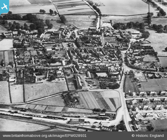
EPW028931 ENGLAND (1929). The town, Potton, 1929. This image has been produced from a copy-negative.
© Copyright OpenStreetMap contributors and licensed by the OpenStreetMap Foundation. 2024. Cartography is licensed as CC BY-SA.
Nearby Images (3)
EPW028931

EPW028932

EPW028933

Details
| Title | [EPW028931] The town, Potton, 1929. This image has been produced from a copy-negative. |
| Reference | EPW028931 |
| Date | September-1929 |
| Link | |
| Place name | POTTON |
| Parish | POTTON |
| District | |
| Country | ENGLAND |
| Easting / Northing | 522180, 249209 |
| Longitude / Latitude | -0.21495397895577, 52.127255764564 |
| National Grid Reference | TL222492 |
Pins
Be the first to add a comment to this image!


