
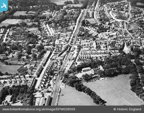
EPW028569 ENGLAND (1929). The railway station and environs, Crawley, 1929. This image has been produced from a copy-negative.
© Copyright OpenStreetMap contributors and licensed by the OpenStreetMap Foundation. 2024. Cartography is licensed as CC BY-SA.
Nearby Images (11)
EPW028569

EAW041928

EPW028573

EPW028574

EAW011066

EPW001485

EPW028572

EPW001481

EPW028576

EAW022731

EPW001483

Details
| Title | [EPW028569] The railway station and environs, Crawley, 1929. This image has been produced from a copy-negative. |
| Reference | EPW028569 |
| Date | August-1929 |
| Link | |
| Place name | CRAWLEY |
| Parish | |
| District | |
| Country | ENGLAND |
| Easting / Northing | 526813, 136366 |
| Longitude / Latitude | -0.18816156351882, 51.112010391668 |
| National Grid Reference | TQ268364 |
Pins
 toby starr |
Friday 3rd of July 2020 11:40:16 AM |


