
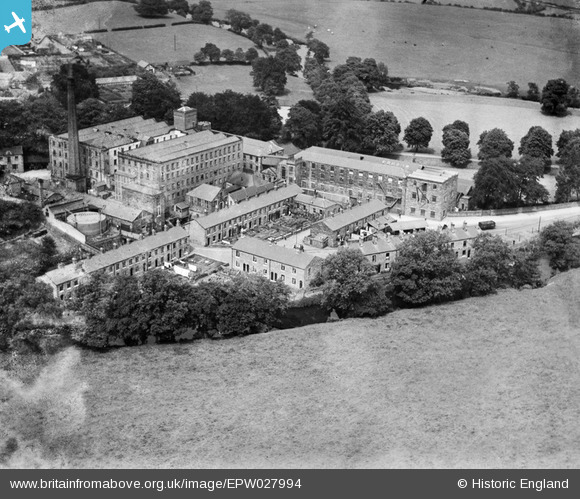
EPW027994 ENGLAND (1929). Mayfield Cotton Mill, Church Mayfield, 1929
© Copyright OpenStreetMap contributors and licensed by the OpenStreetMap Foundation. 2024. Cartography is licensed as CC BY-SA.
Nearby Images (4)
EPW027994

EPW027995

EPW027996

EPW027997

Details
| Title | [EPW027994] Mayfield Cotton Mill, Church Mayfield, 1929 |
| Reference | EPW027994 |
| Date | July-1929 |
| Link | |
| Place name | CHURCH MAYFIELD |
| Parish | MAYFIELD |
| District | |
| Country | ENGLAND |
| Easting / Northing | 415792, 344745 |
| Longitude / Latitude | -1.7646661034418, 52.999485391939 |
| National Grid Reference | SK158447 |
Pins
Be the first to add a comment to this image!
User Comment Contributions
There is a photograph of a warper named Henry Moscrop standing next to a large bale of spun cotton at the mill c. 1890 at http://mayfieldheritage.org.uk/welcome-to-mayfield/old-mayfield-in-pictures/ |
 Finder |
Monday 8th of May 2017 09:41:49 AM |


