
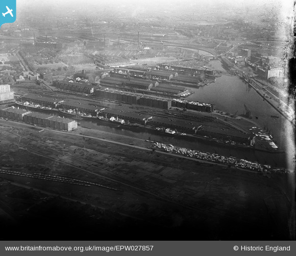
EPW027857 ENGLAND (1929). The Salford Docks, Salford, 1929
© Copyright OpenStreetMap contributors and licensed by the OpenStreetMap Foundation. 2024. Cartography is licensed as CC BY-SA.
Nearby Images (19)
EPW027857

EAW000804

EPW028015

EPW027781

EPW017596

EPW027729

EPW045987

EAW021936

EPW028149

EAW021937

EPW027860

EAW021935

EAW017329

EAW006235

EPW019157

EPW028012

EAW050418

EAW050416

EPW028013

Details
| Title | [EPW027857] The Salford Docks, Salford, 1929 |
| Reference | EPW027857 |
| Date | June-1929 |
| Link | |
| Place name | SALFORD |
| Parish | |
| District | |
| Country | ENGLAND |
| Easting / Northing | 380669, 397291 |
| Longitude / Latitude | -2.2912605707209, 53.471744529347 |
| National Grid Reference | SJ807973 |
Pins
 Bottom Yard |
Thursday 28th of February 2019 05:18:29 PM | |
Bottom Yard |
Thursday 28th of February 2019 05:16:23 PM | |
Bottom Yard |
Thursday 28th of February 2019 05:14:44 PM |


