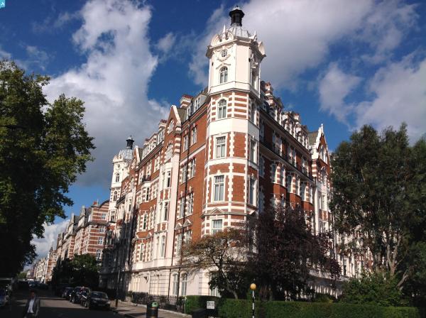
EPW027026 ENGLAND (1929). North Gate, Lord's Cricket Ground and Regent's Park, St John's Wood, 1929

© Copyright OpenStreetMap contributors and licensed by the OpenStreetMap Foundation. 2024. Cartography is licensed as CC BY-SA.
Nearby Images (13)
EPW027026

EPW027021

EPW027023

EPW027024

EPW027022

EPW027025

EPW027020

EPW027019

EPW027018

EAW044240

EAW018354

EPW005641

EAW018355

Details
| Title | [EPW027026] North Gate, Lord's Cricket Ground and Regent's Park, St John's Wood, 1929 |
| Reference | EPW027026 |
| Date | May-1929 |
| Link | |
| Place name | ST JOHN'S WOOD |
| Parish | |
| District | |
| Country | ENGLAND |
| Easting / Northing | 527281, 182989 |
| Longitude / Latitude | -0.16482596308679, 51.530963769967 |
| National Grid Reference | TQ273830 |
Pins
 Class31 |
Wednesday 8th of October 2014 01:57:14 PM | |
Class31 |
Wednesday 8th of October 2014 01:56:13 PM | |
Class31 |
Wednesday 8th of October 2014 01:54:46 PM | |
Class31 |
Wednesday 8th of October 2014 01:52:29 PM | |
Class31 |
Wednesday 8th of October 2014 01:51:24 PM | |
Class31 |
Wednesday 8th of October 2014 01:50:47 PM | |
Class31 |
Monday 3rd of March 2014 11:44:38 AM |