
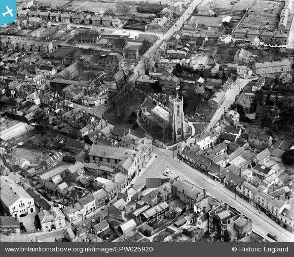
EPW025920 ENGLAND (1929). St Andrew's Church and environs, Halstead, 1929
© Copyright OpenStreetMap contributors and licensed by the OpenStreetMap Foundation. 2024. Cartography is licensed as CC BY-SA.
Nearby Images (7)
EPW025920

EPW025921

EAW029719

EPW025918

EAW029718

EPW025923

EAW029717

Details
| Title | [EPW025920] St Andrew's Church and environs, Halstead, 1929 |
| Reference | EPW025920 |
| Date | 3-April-1929 |
| Link | |
| Place name | HALSTEAD |
| Parish | HALSTEAD |
| District | |
| Country | ENGLAND |
| Easting / Northing | 581527, 230700 |
| Longitude / Latitude | 0.64144295527483, 51.94470411841 |
| National Grid Reference | TL815307 |
Pins
 Jeremy |
Wednesday 28th of August 2013 04:54:43 PM |


