
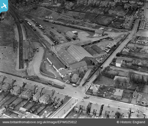
EPW025812 ENGLAND (1929). The Metropolitan Depot, Uxbridge, 1929
© Copyright OpenStreetMap contributors and licensed by the OpenStreetMap Foundation. 2024. Cartography is licensed as CC BY-SA.
Nearby Images (16)
EPW025812

EPW025808

EPW025806

EPW025810

EPW025813

EPW025814

EPW025807

EPW025815

EPW025811

EPW025809

EPW041117

EPW031256

EPW044514

EPW047466

EPW041116

EPW044205

Details
| Title | [EPW025812] The Metropolitan Depot, Uxbridge, 1929 |
| Reference | EPW025812 |
| Date | 1929 |
| Link | |
| Place name | UXBRIDGE |
| Parish | |
| District | |
| Country | ENGLAND |
| Easting / Northing | 505730, 184352 |
| Longitude / Latitude | -0.47501449357934, 51.547664318414 |
| National Grid Reference | TQ057844 |
Pins
 Isleworth1961 |
Sunday 9th of June 2013 11:46:25 PM | |
The sudden "dead-end" nature of the train lines, beautifully shown in this photo, and the fact that the station was away from the town centre, can be explained by the initial plans to extend these lines westwards to reach High Wycombe.These plans were soon abandoned. |
moses72 |
Friday 20th of December 2013 05:52:59 PM |
dave43 |
Tuesday 30th of October 2012 06:01:44 PM |


