
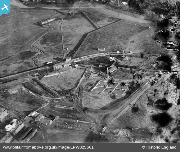
EPW025601 ENGLAND (1929). The Beckton Sewage Works, Beckton, 1929
© Copyright OpenStreetMap contributors and licensed by the OpenStreetMap Foundation. 2024. Cartography is licensed as CC BY-SA.
Nearby Images (14)
EPW025601

EPW025605

EPW025603

EPW025604

EPW037510

EAW022381

EPW037873

EPW037508

EPW037877

EPW037879

EPW037876

EPW037874

EPW037878

EPW037875

Details
| Title | [EPW025601] The Beckton Sewage Works, Beckton, 1929 |
| Reference | EPW025601 |
| Date | January-1929 |
| Link | |
| Place name | BECKTON |
| Parish | |
| District | |
| Country | ENGLAND |
| Easting / Northing | 545051, 181743 |
| Longitude / Latitude | 0.090701632070067, 51.51548072597 |
| National Grid Reference | TQ451817 |
Pins
Be the first to add a comment to this image!


