
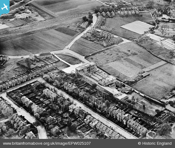
EPW025107 ENGLAND (1928). The Renshaw Marzipan Factory on Lock's Lane, Mitcham, 1928
© Copyright OpenStreetMap contributors and licensed by the OpenStreetMap Foundation. 2024. Cartography is licensed as CC BY-SA.
Nearby Images (12)
EPW025107

EAW049831

EPW025109

EAW049828

EPW025106

EAW049833

EAW049832

EAW049827

EAW049829

EAW049830

EAW047586

EAW047588

Details
| Title | [EPW025107] The Renshaw Marzipan Factory on Lock's Lane, Mitcham, 1928 |
| Reference | EPW025107 |
| Date | October-1928 |
| Link | |
| Place name | MITCHAM |
| Parish | |
| District | |
| Country | ENGLAND |
| Easting / Northing | 528122, 169447 |
| Longitude / Latitude | -0.15761741524395, 51.409059550739 |
| National Grid Reference | TQ281694 |
Pins
 mikeB |
Thursday 11th of April 2019 10:13:39 AM | |
Johnners |
Friday 27th of September 2013 10:25:27 AM | |
Johnners |
Friday 27th of September 2013 10:23:47 AM | |
Johnners |
Friday 27th of September 2013 10:22:36 AM | |
Johnners |
Friday 27th of September 2013 10:20:32 AM | |
Johnners |
Tuesday 4th of June 2013 11:21:46 AM | |
Johnners |
Tuesday 4th of June 2013 11:21:04 AM |
User Comment Contributions
 1928 View from north west |
Wade |
Saturday 17th of January 2015 08:16:03 AM |


