
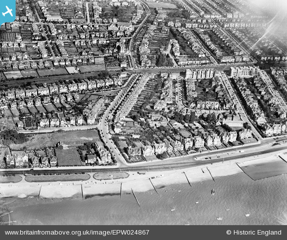
EPW024867 ENGLAND (1928). Residential area around Crowstone Avenue, Westcliff-on-Sea, 1928
© Copyright OpenStreetMap contributors and licensed by the OpenStreetMap Foundation. 2024. Cartography is licensed as CC BY-SA.
Nearby Images (15)
EPW024867

EPW032902

EPW036716

EAW043704

EPW036711

EPW036989

EPW037018

EPW037019

EPW024876

EPW037002

EPW024864

EPW054674

EAW043706

EAW053103

EPW040970

Details
| Title | [EPW024867] Residential area around Crowstone Avenue, Westcliff-on-Sea, 1928 |
| Reference | EPW024867 |
| Date | 3-October-1928 |
| Link | |
| Place name | WESTCLIFF-ON-SEA |
| Parish | |
| District | |
| Country | ENGLAND |
| Easting / Northing | 586116, 185459 |
| Longitude / Latitude | 0.68393670886223, 51.536825222248 |
| National Grid Reference | TQ861855 |


