
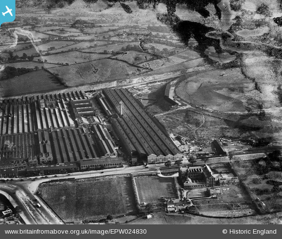
EPW024830 ENGLAND (1928). The Longbridge Motor Works and Nazareth House, Longbridge, 1928. This image has been produced from a damaged negative.
© Copyright OpenStreetMap contributors and licensed by the OpenStreetMap Foundation. 2024. Cartography is licensed as CC BY-SA.
Nearby Images (19)
EPW024830

EPW026900

EPW026897

EPW026895

EPW024826

EPW010506

EPW024827

EPW047800

EPW024825

EPW005368

EPW024828

EPW024829

EPW026899

EPW047794

EPW047797

EPW010505

EPW047805

EPW026901

EPW047801

Details
| Title | [EPW024830] The Longbridge Motor Works and Nazareth House, Longbridge, 1928. This image has been produced from a damaged negative. |
| Reference | EPW024830 |
| Date | September-1928 |
| Link | |
| Place name | LONGBRIDGE |
| Parish | |
| District | |
| Country | ENGLAND |
| Easting / Northing | 400942, 277134 |
| Longitude / Latitude | -1.9861558084322, 52.391848605383 |
| National Grid Reference | SP009771 |
Pins
 John Wass |
Tuesday 16th of September 2014 08:13:10 PM |


