
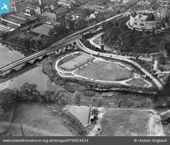
EPW024634 ENGLAND (1928). Tamworth Castle and Park, Tamworth, 1928
© Copyright OpenStreetMap contributors and licensed by the OpenStreetMap Foundation. 2024. Cartography is licensed as CC BY-SA.
Nearby Images (16)
EPW024634

EAW007513

EPW024630

EAW007508

EPW019731

EAW007509

EAW007514

EPW019732

EAW003617

EAW007510

EAW007511

EAW007512

EAW003616

EAW003618

EPW019733

EPW024637

Details
| Title | [EPW024634] Tamworth Castle and Park, Tamworth, 1928 |
| Reference | EPW024634 |
| Date | September-1928 |
| Link | |
| Place name | TAMWORTH |
| Parish | |
| District | |
| Country | ENGLAND |
| Easting / Northing | 420593, 303828 |
| Longitude / Latitude | -1.6957020942619, 52.631463334057 |
| National Grid Reference | SK206038 |
Pins
Be the first to add a comment to this image!
User Comment Contributions
The tennis court in the middle of the photo is now a car park |
 ian-500 |
Friday 6th of July 2012 01:12:51 PM |


