
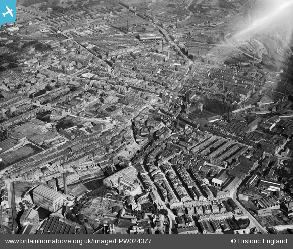
EPW024377 ENGLAND (1928). The town centre, Keighley, from the south-west, 1928
© Copyright OpenStreetMap contributors and licensed by the OpenStreetMap Foundation. 2024. Cartography is licensed as CC BY-SA.
Nearby Images (3)
EPW024377

EPW024371

EPW024376

Details
| Title | [EPW024377] The town centre, Keighley, from the south-west, 1928 |
| Reference | EPW024377 |
| Date | September-1928 |
| Link | |
| Place name | KEIGHLEY |
| Parish | KEIGHLEY |
| District | |
| Country | ENGLAND |
| Easting / Northing | 405736, 440933 |
| Longitude / Latitude | -1.9127685133582, 53.864374786297 |
| National Grid Reference | SE057409 |
Pins
 John W |
Friday 10th of June 2016 10:03:29 PM | |
Clive |
Saturday 22nd of November 2014 04:09:35 PM | |
 Class31 |
Tuesday 14th of October 2014 08:15:17 PM | |
Class31 |
Tuesday 14th of October 2014 08:09:38 AM |


