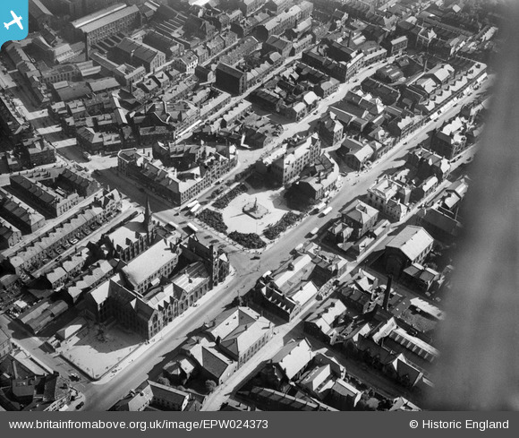
EPW024373 ENGLAND (1928). The town hall and Mechanics Institute, Keighley, 1928
© Copyright OpenStreetMap contributors and licensed by the OpenStreetMap Foundation. 2024. Cartography is licensed as CC BY-SA.
Nearby Images (4)
EPW024373

EPW024456

EPW024455

EPW024458

Details
| Title | [EPW024373] The town hall and Mechanics Institute, Keighley, 1928 |
| Reference | EPW024373 |
| Date | September-1928 |
| Link | |
| Place name | KEIGHLEY |
| Parish | KEIGHLEY |
| District | |
| Country | ENGLAND |
| Easting / Northing | 406074, 441300 |
| Longitude / Latitude | -1.9076210431545, 53.867669866424 |
| National Grid Reference | SE061413 |