
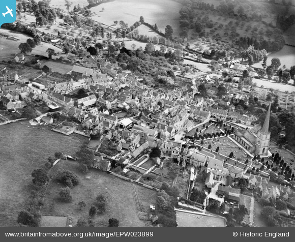
EPW023899 ENGLAND (1928). St Mary's Church and the town, Painswick, 1928
© Copyright OpenStreetMap contributors and licensed by the OpenStreetMap Foundation. 2024. Cartography is licensed as CC BY-SA.
Nearby Images (11)
EPW023899

EPW029933

EPW023901

EPW023898

EPW029936

EPW029930

EPW023900

EPW023905

EPW029934

EPW029932

EPW029931

Details
| Title | [EPW023899] St Mary's Church and the town, Painswick, 1928 |
| Reference | EPW023899 |
| Date | September-1928 |
| Link | |
| Place name | PAINSWICK |
| Parish | PAINSWICK |
| District | |
| Country | ENGLAND |
| Easting / Northing | 386715, 209728 |
| Longitude / Latitude | -2.192616172387, 51.785603532513 |
| National Grid Reference | SO867097 |


