
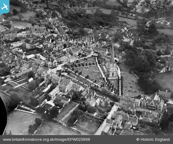
EPW023898 ENGLAND (1928). St Mary's Church and the town, Painswick, 1928
© Copyright OpenStreetMap contributors and licensed by the OpenStreetMap Foundation. 2024. Cartography is licensed as CC BY-SA.
Nearby Images (11)
EPW023898

EPW023900

EPW023901

EPW023905

EPW029933

EPW029934

EPW023899

EPW029936

EPW029930

EPW029932

EPW029931

Details
| Title | [EPW023898] St Mary's Church and the town, Painswick, 1928 |
| Reference | EPW023898 |
| Date | September-1928 |
| Link | |
| Place name | PAINSWICK |
| Parish | PAINSWICK |
| District | |
| Country | ENGLAND |
| Easting / Northing | 386666, 209674 |
| Longitude / Latitude | -2.1933245322061, 51.785116797589 |
| National Grid Reference | SO867097 |
Pins
 Class31 |
Wednesday 17th of October 2012 02:30:29 PM | |
Class31 |
Wednesday 17th of October 2012 02:29:30 PM | |
Class31 |
Wednesday 17th of October 2012 02:28:44 PM | |
Class31 |
Wednesday 17th of October 2012 02:28:22 PM | |
Class31 |
Wednesday 17th of October 2012 02:26:34 PM | |
Class31 |
Wednesday 17th of October 2012 02:22:22 PM |


