
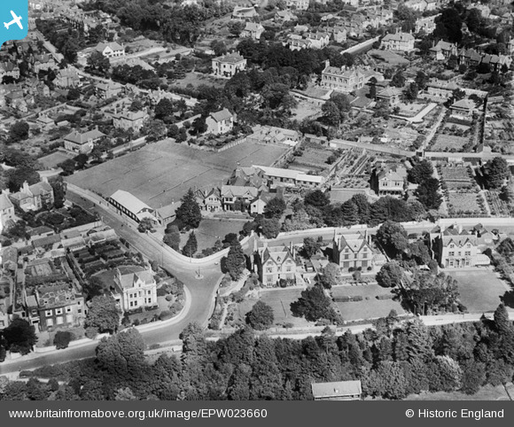
EPW023660 ENGLAND (1928). Southlands School on Rolle Road, Exmouth, 1928.
© Copyright OpenStreetMap contributors and licensed by the OpenStreetMap Foundation. 2024. Cartography is licensed as CC BY-SA.
Nearby Images (3)
EPW023660

EPW023920

EPW039692

Details
| Title | [EPW023660] Southlands School on Rolle Road, Exmouth, 1928. |
| Reference | EPW023660 |
| Date | September-1928 |
| Link | |
| Place name | EXMOUTH |
| Parish | EXMOUTH |
| District | |
| Country | ENGLAND |
| Easting / Northing | 300601, 80440 |
| Longitude / Latitude | -3.4051087223736, 50.614606011786 |
| National Grid Reference | SY006804 |
Pins
 oppo |
Wednesday 13th of September 2017 11:26:15 PM | |
 Class31 |
Friday 3rd of August 2012 08:21:05 PM | |
Class31 |
Friday 3rd of August 2012 08:20:35 PM | |
Class31 |
Friday 3rd of August 2012 08:19:54 PM | |
Class31 |
Friday 3rd of August 2012 08:19:23 PM | |
Class31 |
Friday 3rd of August 2012 08:18:53 PM |


