
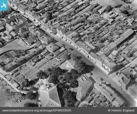
EPW023505 ENGLAND (1928). The High Street, Egham, 1928
© Copyright OpenStreetMap contributors and licensed by the OpenStreetMap Foundation. 2024. Cartography is licensed as CC BY-SA.
Nearby Images (8)
EPW023505

EPW026266

EPW026252

EPW006214

EPW026267

EPW023512

EPW023510

EPW026264

Details
| Title | [EPW023505] The High Street, Egham, 1928 |
| Reference | EPW023505 |
| Date | September-1928 |
| Link | |
| Place name | EGHAM |
| Parish | |
| District | |
| Country | ENGLAND |
| Easting / Northing | 501242, 171396 |
| Longitude / Latitude | -0.5434404475599, 51.432018257189 |
| National Grid Reference | TQ012714 |
Pins
 Class31 |
Tuesday 8th of September 2015 08:39:51 PM | |
 richburton |
Monday 23rd of March 2015 10:33:50 PM | |
richburton |
Monday 23rd of March 2015 10:33:21 PM |

User Comment Contributions
 St. John's Church, Egham, 07/09/2015 |
Class31 |
Tuesday 8th of September 2015 08:39:00 PM |


