
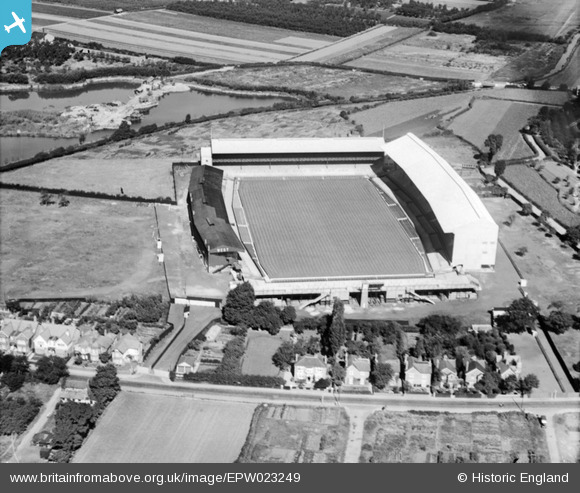
EPW023249 ENGLAND (1928). Twickenham Rugby Stadium, Twickenham, 1928
© Copyright OpenStreetMap contributors and licensed by the OpenStreetMap Foundation. 2024. Cartography is licensed as CC BY-SA.
Nearby Images (22)
EPW023249

EPW025842

EPW049453

EPW025839

EPW025844

EPW025845

EPR000638

EPW017385

EPW025843

EPW049450

EPW049454

EPW049451

EPW025840

EPW049448

EPW022945

EPW025841

EPW049447

EPW049449

EPW049455

EPW049446

EPW049452

EPW034843

Details
| Title | [EPW023249] Twickenham Rugby Stadium, Twickenham, 1928 |
| Reference | EPW023249 |
| Date | September-1928 |
| Link | |
| Place name | TWICKENHAM |
| Parish | |
| District | |
| Country | ENGLAND |
| Easting / Northing | 515326, 174279 |
| Longitude / Latitude | -0.33996141612151, 51.455240980855 |
| National Grid Reference | TQ153743 |
Pins
 Keith Cheriton |
Thursday 6th of February 2014 04:36:07 PM |


