
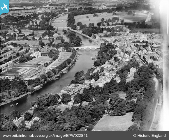
EPW022841 ENGLAND (1928). Bridges over the River Thames, Richmond, from the south-east, 1928
© Copyright OpenStreetMap contributors and licensed by the OpenStreetMap Foundation. 2024. Cartography is licensed as CC BY-SA.
Nearby Images (17)
EPW022841

EPW036447

EPW036446

EPW036450

EPW008870

EPW036444

EPW036443

EPW036449

EAW026800

EPW035019

EPW036448

EPW036445

EPR000468

EPW001699

EAW026801

EPW001698

EAW042757

Details
| Title | [EPW022841] Bridges over the River Thames, Richmond, from the south-east, 1928 |
| Reference | EPW022841 |
| Date | August-1928 |
| Link | |
| Place name | RICHMOND |
| Parish | |
| District | |
| Country | ENGLAND |
| Easting / Northing | 518067, 174166 |
| Longitude / Latitude | -0.3005627718363, 51.453660164153 |
| National Grid Reference | TQ181742 |
Pins
 Martin Devlin |
Sunday 12th of April 2020 12:32:05 PM | |
Martin Devlin |
Sunday 12th of April 2020 12:22:37 PM |
User Comment Contributions
 Richmond upon Thames |
 Alan McFaden |
Thursday 4th of December 2014 10:03:55 AM |


