
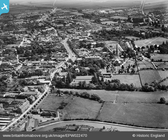
EPW022470 ENGLAND (1928). All Saints Church and the High Street, Leighton Buzzard, 1928
© Copyright OpenStreetMap contributors and licensed by the OpenStreetMap Foundation. 2024. Cartography is licensed as CC BY-SA.
Nearby Images (7)
EPW022470

EPW056935

EAW029608

EPW056939

EPW056936

EPW056937

EAW016588

Details
| Title | [EPW022470] All Saints Church and the High Street, Leighton Buzzard, 1928 |
| Reference | EPW022470 |
| Date | 9-August-1928 |
| Link | |
| Place name | LEIGHTON BUZZARD |
| Parish | LEIGHTON-LINSLADE |
| District | |
| Country | ENGLAND |
| Easting / Northing | 491882, 224946 |
| Longitude / Latitude | -0.66396929225302, 51.915018600373 |
| National Grid Reference | SP919249 |
Pins
 Jo |
Friday 16th of April 2021 07:37:35 AM | |
Shaun |
Thursday 7th of August 2014 01:12:49 PM | |
Brightonboy |
Monday 23rd of December 2013 09:35:43 PM | |
Brightonboy |
Tuesday 16th of April 2013 09:02:11 PM | |
Brightonboy |
Tuesday 16th of April 2013 09:00:45 PM |


