
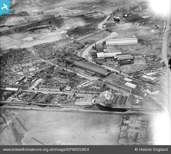
EPW021854 ENGLAND (1928). Crown Bridge Works and Staffordshire Edge Tool Works, West Bromwich, 1928
© Copyright OpenStreetMap contributors and licensed by the OpenStreetMap Foundation. 2024. Cartography is licensed as CC BY-SA.
Nearby Images (10)
EPW021854

EPW021858

EPW021855

EPW021856

EPW021859

EPW021857

EAW002084

EPW021851

EAW002080

EAW002082

Details
| Title | [EPW021854] Crown Bridge Works and Staffordshire Edge Tool Works, West Bromwich, 1928 |
| Reference | EPW021854 |
| Date | July-1928 |
| Link | |
| Place name | WEST BROMWICH |
| Parish | |
| District | |
| Country | ENGLAND |
| Easting / Northing | 398519, 292010 |
| Longitude / Latitude | -2.0218317084942, 52.525598114723 |
| National Grid Reference | SO985920 |
Pins
 Ray Shill |
Friday 15th of August 2014 05:21:49 PM | |
DaveT |
Tuesday 15th of October 2013 09:54:15 AM | |
DaveT |
Tuesday 15th of October 2013 09:51:20 AM | |
DaveT |
Tuesday 15th of October 2013 09:48:58 AM |


