
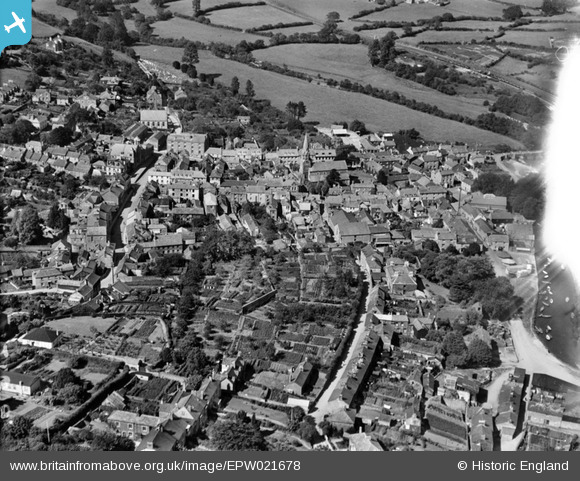
EPW021678 ENGLAND (1928). The town centre, Lostwithiel, 1928
© Copyright OpenStreetMap contributors and licensed by the OpenStreetMap Foundation. 2024. Cartography is licensed as CC BY-SA.
Nearby Images (11)
EPW021678

EPW033041

EPW054821

EPW021676

EPW054820

EPW054819

EPW033039

EPW033042

EPW021677

EPW033038

EPW033040

Details
| Title | [EPW021678] The town centre, Lostwithiel, 1928 |
| Reference | EPW021678 |
| Date | 24-June-1928 |
| Link | |
| Place name | LOSTWITHIEL |
| Parish | LOSTWITHIEL |
| District | |
| Country | ENGLAND |
| Easting / Northing | 210392, 59727 |
| Longitude / Latitude | -4.6686608486203, 50.406172379574 |
| National Grid Reference | SX104597 |
Pins
User Comment Contributions
 Quay Street 22/04/2014 |
 Class31 |
Friday 25th of April 2014 10:28:07 AM |


