
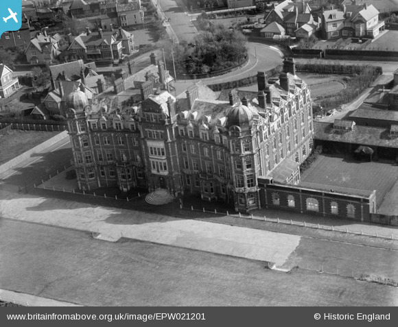
EPW021201 ENGLAND (1928). The Grand Hotel, Sheringham, 1928
© Copyright OpenStreetMap contributors and licensed by the OpenStreetMap Foundation. 2024. Cartography is licensed as CC BY-SA.
Nearby Images (6)
EPW021201

EPW001805

EAW051657

EPW001804

EAW038319

EPW001803

Details
| Title | [EPW021201] The Grand Hotel, Sheringham, 1928 |
| Reference | EPW021201 |
| Date | May-1928 |
| Link | |
| Place name | SHERINGHAM |
| Parish | SHERINGHAM |
| District | |
| Country | ENGLAND |
| Easting / Northing | 615500, 343457 |
| Longitude / Latitude | 1.2078090852334, 52.944837070214 |
| National Grid Reference | TG155435 |
Pins
 Chris Booty |
Wednesday 18th of April 2018 04:15:47 PM | |
Farrowbee |
Wednesday 25th of March 2015 12:33:53 PM | |
David D Draper |
Monday 17th of June 2013 03:08:41 PM |
User Comment Contributions
How were they ever allowed to knock this building down :( |
whit3star |
Thursday 28th of June 2012 09:05:25 PM |


