
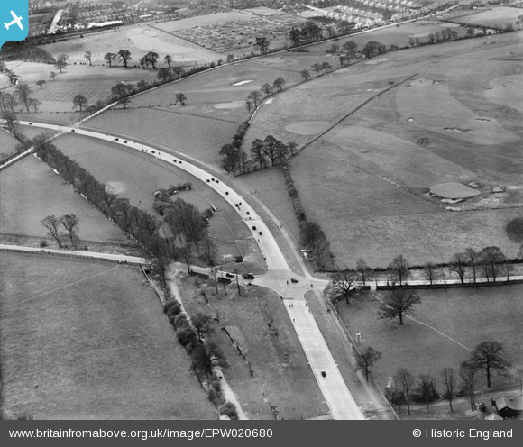
EPW020680 ENGLAND (1928). The Kingston Bypass, Coombe, 1928
© Copyright OpenStreetMap contributors and licensed by the OpenStreetMap Foundation. 2024. Cartography is licensed as CC BY-SA.
Nearby Images (3)
EPW020680

EPW020678

EPW016631

Details
| Title | [EPW020680] The Kingston Bypass, Coombe, 1928 |
| Reference | EPW020680 |
| Date | March-1928 |
| Link | |
| Place name | COOMBE |
| Parish | |
| District | |
| Country | ENGLAND |
| Easting / Northing | 521765, 169772 |
| Longitude / Latitude | -0.2488717931754, 51.413381738321 |
| National Grid Reference | TQ218698 |
Pins
User Comment Contributions
In the foreground the newly built Bypass crosses Coombe Lane. Beyond, to the right is the Malden Golf Course. In the distance you can see the Alric Avenue allotments. Note there seems to be a steam train approaching Newe Malden. |
 alany |
Tuesday 20th of November 2012 03:20:44 PM |


