
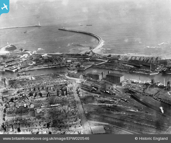
EPW020546 ENGLAND (1928). North Half Tide Basin, Hudson Dock North and New South Pier, Sunderland, 1928
© Copyright OpenStreetMap contributors and licensed by the OpenStreetMap Foundation. 2024. Cartography is licensed as CC BY-SA.
Nearby Images (14)
EPW020546

EAW003170

EAW003182

EPW051128

EAW003176

EAW003183

EAW003171

EAW001018

EAW003177

EPW020536

EAW003172

EAW003178

EAW003184

EAW003175

Details
| Title | [EPW020546] North Half Tide Basin, Hudson Dock North and New South Pier, Sunderland, 1928 |
| Reference | EPW020546 |
| Date | March-1928 |
| Link | |
| Place name | SUNDERLAND |
| Parish | |
| District | |
| Country | ENGLAND |
| Easting / Northing | 441048, 557696 |
| Longitude / Latitude | -1.3596404757586, 54.912200379805 |
| National Grid Reference | NZ410577 |
Pins
 Jane |
Sunday 14th of February 2016 07:22:54 PM | |
Jane |
Sunday 14th of February 2016 07:19:50 PM | |
Fantasma |
Thursday 6th of September 2012 04:36:23 PM | |
Fantasma |
Thursday 6th of September 2012 04:35:30 PM | |
Fantasma |
Thursday 6th of September 2012 04:24:28 PM | |
Fantasma |
Thursday 6th of September 2012 04:23:30 PM | |
Fantasma |
Thursday 6th of September 2012 04:22:47 PM | |
Fantasma |
Thursday 6th of September 2012 04:21:56 PM | |
Fantasma |
Thursday 6th of September 2012 04:17:43 PM |


