
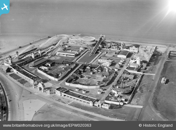
EPW020363 ENGLAND (1928). Pleasureland, Southport, 1928
© Copyright OpenStreetMap contributors and licensed by the OpenStreetMap Foundation. 2024. Cartography is licensed as CC BY-SA.
Nearby Images (13)
EPW020363

EPW020365

EPW045243

EPW058497

EPW020364

EPW013091

EAW038522

EPW045244

EPW045246

EAW010136

EAW038520

EPW018657

EAW010137

Details
| Title | [EPW020363] Pleasureland, Southport, 1928 |
| Reference | EPW020363 |
| Date | March-1928 |
| Link | |
| Place name | SOUTHPORT |
| Parish | |
| District | |
| Country | ENGLAND |
| Easting / Northing | 332761, 417372 |
| Longitude / Latitude | -3.017332748268, 53.648292976436 |
| National Grid Reference | SD328174 |
Pins
 Class31 |
Wednesday 24th of October 2012 09:00:38 AM |


