
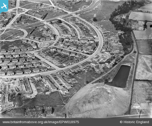
EPW018975 ENGLAND (1927). Construction of the Manor Estate, Sheffield, 1927
© Copyright OpenStreetMap contributors and licensed by the OpenStreetMap Foundation. 2024. Cartography is licensed as CC BY-SA.
Nearby Images (5)
EPW018975

EPW018971

EPW018972

EPW018976

EPW018973

Details
| Title | [EPW018975] Construction of the Manor Estate, Sheffield, 1927 |
| Reference | EPW018975 |
| Date | July-1927 |
| Link | |
| Place name | SHEFFIELD |
| Parish | |
| District | |
| Country | ENGLAND |
| Easting / Northing | 438390, 385146 |
| Longitude / Latitude | -1.4230686644585, 53.361526688042 |
| National Grid Reference | SK384851 |
Pins
 Railway Man |
Friday 5th of July 2019 09:51:46 PM | |
Railway Man |
Friday 5th of July 2019 09:47:31 PM | |
Railway Man |
Friday 5th of July 2019 09:46:21 PM | |
Railway Man |
Friday 5th of July 2019 09:45:08 PM | |
Railway Man |
Friday 5th of July 2019 09:43:13 PM | |
RichardL |
Tuesday 30th of September 2014 12:47:53 PM |


