
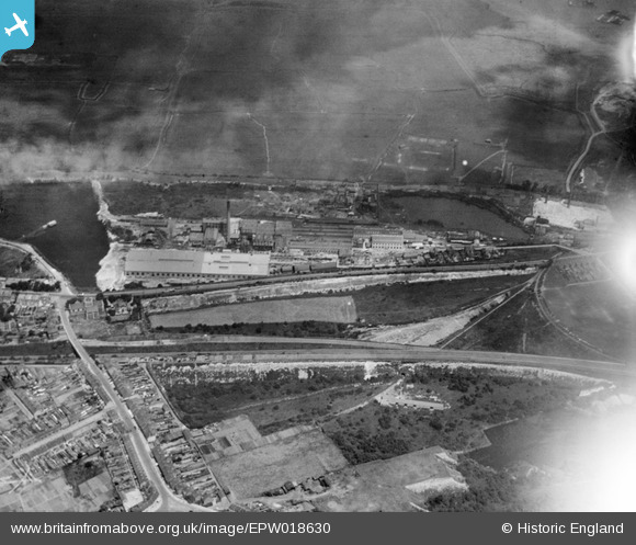
EPW018630 ENGLAND (1927). The New Northfleet Paper Mills, Swanscombe, 1927
© Copyright OpenStreetMap contributors and licensed by the OpenStreetMap Foundation. 2024. Cartography is licensed as CC BY-SA.
Nearby Images (25)
EPW018630

EPW018631

EPW040724

EPW040720

EPW040947

EAW050798

EPW040732

EPW040725

EPW040951

EPW040721

EAW050802

EAW050799

EAW050801

EPW040949

EAW050796

EPW040948

EAW050800

EPW028498

EPW028506

EAW050793

EPW028502

EAW050797

EPW028503

EPW040718

EPW018632

Details
| Title | [EPW018630] The New Northfleet Paper Mills, Swanscombe, 1927 |
| Reference | EPW018630 |
| Date | 22-June-1927 |
| Link | |
| Place name | SWANSCOMBE |
| Parish | SWANSCOMBE AND GREENHITHE |
| District | |
| Country | ENGLAND |
| Easting / Northing | 560885, 174937 |
| Longitude / Latitude | 0.31563413789053, 51.450039964511 |
| National Grid Reference | TQ609749 |
Pins
 jwh |
Sunday 16th of April 2023 09:41:29 PM |


