
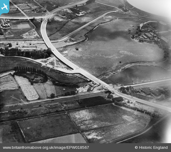
EPW018567 ENGLAND (1927). Cook's Ferry Public House and the Lea Valley Viaduct and environs, Edmonton, 1927
© Copyright OpenStreetMap contributors and licensed by the OpenStreetMap Foundation. 2024. Cartography is licensed as CC BY-SA.
Nearby Images (20)
EPW018567

EPW018565

EPW049529

EPW049703

EPW052282

EPW056321

EPW049710

EPW053837

EPW052272

EPW056818

EPW056823

EPW056816

EPW052271

EPW018568

EPW050859

EPW049711

EPW058457

EPW056320

EPW058467

EPW053836

Details
| Title | [EPW018567] Cook's Ferry Public House and the Lea Valley Viaduct and environs, Edmonton, 1927 |
| Reference | EPW018567 |
| Date | June-1927 |
| Link | |
| Place name | EDMONTON |
| Parish | |
| District | |
| Country | ENGLAND |
| Easting / Northing | 535936, 192269 |
| Longitude / Latitude | -0.036520745106054, 51.612346567652 |
| National Grid Reference | TQ359923 |
Pins
Be the first to add a comment to this image!


