
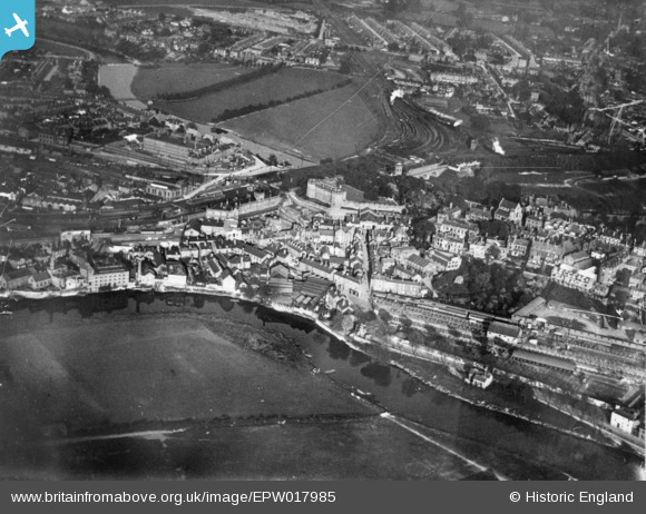
EPW017985 ENGLAND (1927). The railway station, castle and environs, Shrewsbury, 1927. This image has been produced from a copy-negative.
© Copyright OpenStreetMap contributors and licensed by the OpenStreetMap Foundation. 2024. Cartography is licensed as CC BY-SA.
Nearby Images (3)
EPW017985

EAW001632

EAW001631

Details
| Title | [EPW017985] The railway station, castle and environs, Shrewsbury, 1927. This image has been produced from a copy-negative. |
| Reference | EPW017985 |
| Date | 3-May-1927 |
| Link | |
| Place name | SHREWSBURY |
| Parish | SHREWSBURY |
| District | |
| Country | ENGLAND |
| Easting / Northing | 349364, 312915 |
| Longitude / Latitude | -2.7496040476895, 52.71118334156 |
| National Grid Reference | SJ494129 |


