
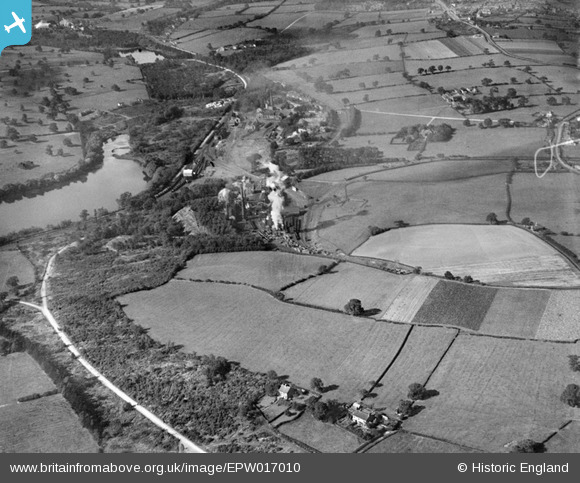
EPW017010 ENGLAND (1926). Woodside Colliery, Shipley, 1926
© Copyright OpenStreetMap contributors and licensed by the OpenStreetMap Foundation. 2024. Cartography is licensed as CC BY-SA.
Nearby Images (5)
EPW017010

EPW017011

EPW017007

EPW017012

EPW017009

Details
| Title | [EPW017010] Woodside Colliery, Shipley, 1926 |
| Reference | EPW017010 |
| Date | October-1926 |
| Link | |
| Place name | SHIPLEY |
| Parish | SHIPLEY |
| District | |
| Country | ENGLAND |
| Easting / Northing | 444888, 344373 |
| Longitude / Latitude | -1.3311482201345, 52.994492820404 |
| National Grid Reference | SK449444 |
Pins
Be the first to add a comment to this image!


