
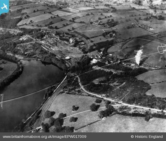
EPW017009 ENGLAND (1926). Woodside Colliery, Shipley, 1926. This image has been produced from a damaged print.
© Copyright OpenStreetMap contributors and licensed by the OpenStreetMap Foundation. 2024. Cartography is licensed as CC BY-SA.
Nearby Images (7)
EPW017009

EPW017007

EPW017011

EPW017002

EPW017010

EPW017012

EPW017006

Details
| Title | [EPW017009] Woodside Colliery, Shipley, 1926. This image has been produced from a damaged print. |
| Reference | EPW017009 |
| Date | October-1926 |
| Link | |
| Place name | SHIPLEY |
| Parish | SHIPLEY |
| District | |
| Country | ENGLAND |
| Easting / Northing | 444696, 344430 |
| Longitude / Latitude | -1.3340010128497, 52.995021285322 |
| National Grid Reference | SK447444 |
Pins
Be the first to add a comment to this image!


