
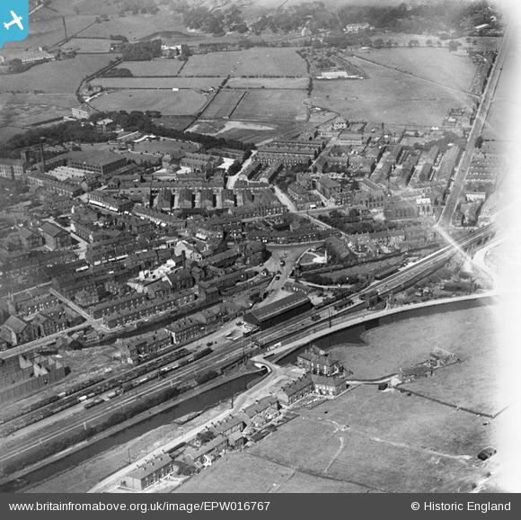
EPW016767 ENGLAND (1926). Station Road and the town centre, Littleborough, 1926
© Copyright OpenStreetMap contributors and licensed by the OpenStreetMap Foundation. 2024. Cartography is licensed as CC BY-SA.
Nearby Images (5)
EPW016767

EPW016766

EPW016768

EPW013231

EPW013230

Details
| Title | [EPW016767] Station Road and the town centre, Littleborough, 1926 |
| Reference | EPW016767 |
| Date | August-1926 |
| Link | |
| Place name | LITTLEBOROUGH |
| Parish | |
| District | |
| Country | ENGLAND |
| Easting / Northing | 393765, 416345 |
| Longitude / Latitude | -2.0943236722856, 53.643345847484 |
| National Grid Reference | SD938163 |
Pins
User Comment Contributions
 Rochdale Canal and the Manchester and Leeds Railway in the foreground. Littleborough Station is prominent. |
 Frank S |
Saturday 30th of June 2012 04:26:17 PM |


