
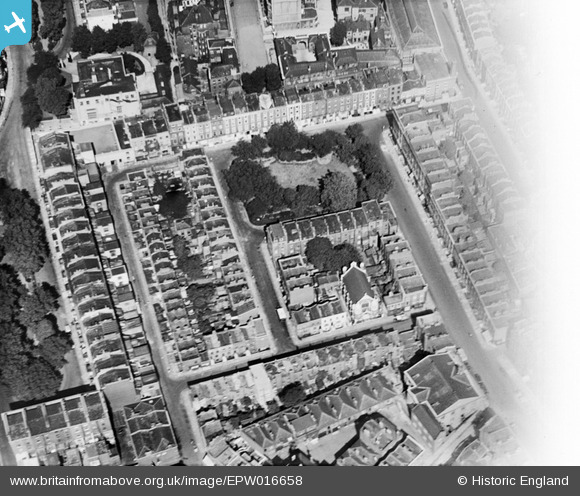
EPW016658 ENGLAND (1926). Montpelier Square, Knightsbridge, 1926
© Copyright OpenStreetMap contributors and licensed by the OpenStreetMap Foundation. 2024. Cartography is licensed as CC BY-SA.
Nearby Images (8)
EPW016658

EPW030076

EAW000554

EAW006441

EAW006442

EAW022139

EAW021419

EPW010190

Details
| Title | [EPW016658] Montpelier Square, Knightsbridge, 1926 |
| Reference | EPW016658 |
| Date | August-1926 |
| Link | |
| Place name | KNIGHTSBRIDGE |
| Parish | |
| District | |
| Country | ENGLAND |
| Easting / Northing | 527344, 179473 |
| Longitude / Latitude | -0.16518861702048, 51.499348226949 |
| National Grid Reference | TQ273795 |
Pins
Be the first to add a comment to this image!


