
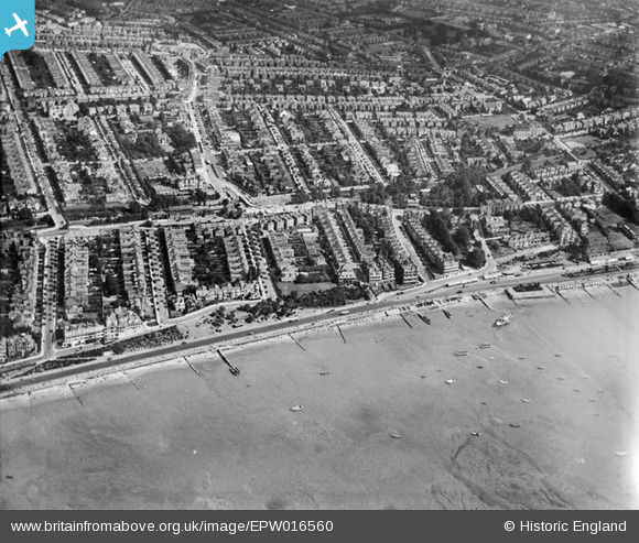
EPW016560 ENGLAND (1926). The Esplanade and surrounding housing around Leonard Road and environs, Westcliff-on-Sea, 1926
© Copyright OpenStreetMap contributors and licensed by the OpenStreetMap Foundation. 2024. Cartography is licensed as CC BY-SA.
Nearby Images (15)
EPW016560

EPW024894

EAW053101

EPW032904

EPW058502

EAW053088

EPW036729

EPW036996

EPW024878

EPW000539

EPW037021

EPW024865

EPW054668

EPW036710

EPW037025

Details
| Title | [EPW016560] The Esplanade and surrounding housing around Leonard Road and environs, Westcliff-on-Sea, 1926 |
| Reference | EPW016560 |
| Date | 26-August-1926 |
| Link | |
| Place name | WESTCLIFF-ON-SEA |
| Parish | |
| District | |
| Country | ENGLAND |
| Easting / Northing | 586812, 185339 |
| Longitude / Latitude | 0.69389797436487, 51.535517413903 |
| National Grid Reference | TQ868853 |
Pins
Be the first to add a comment to this image!


