
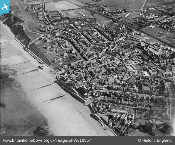
EPW016557 ENGLAND (1926). The Promenade and Beach Road area, Sheringham, 1926
© Copyright OpenStreetMap contributors and licensed by the OpenStreetMap Foundation. 2024. Cartography is licensed as CC BY-SA.
Nearby Images (11)
EPW016557

EAW051653

EAW038318

EPW021202

EPW016558

EPW021200

EAW051654

EPW001974

EPW001802

EAW051658

EPW021198

Details
| Title | [EPW016557] The Promenade and Beach Road area, Sheringham, 1926 |
| Reference | EPW016557 |
| Date | 26-August-1926 |
| Link | |
| Place name | SHERINGHAM |
| Parish | SHERINGHAM |
| District | |
| Country | ENGLAND |
| Easting / Northing | 616011, 343366 |
| Longitude / Latitude | 1.2153418536289, 52.943814841735 |
| National Grid Reference | TG160434 |
Pins
 Farrowbee |
Saturday 28th of March 2015 06:50:04 PM | |
Farrowbee |
Friday 27th of March 2015 12:10:58 PM | |
Farrowbee |
Friday 27th of March 2015 12:09:01 PM | |
Farrowbee |
Thursday 26th of March 2015 10:44:52 AM | |
Farrowbee |
Thursday 26th of March 2015 10:42:50 AM | |
Farrowbee |
Thursday 26th of March 2015 10:39:02 AM | |
Farrowbee |
Wednesday 25th of March 2015 10:15:08 AM | |
JulieW |
Wednesday 27th of June 2012 09:29:18 PM |


