
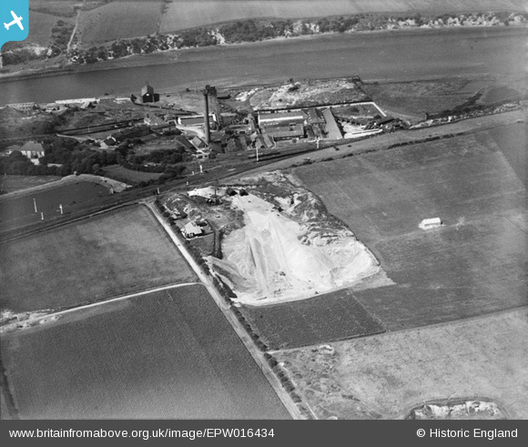
EPW016434 ENGLAND (1926). Ford Quarry and the Ford Paper Mills, South Hylton, 1926
© Copyright OpenStreetMap contributors and licensed by the OpenStreetMap Foundation. 2024. Cartography is licensed as CC BY-SA.
Nearby Images (13)
EPW016434

EPW016436

EPW016432

EPW016433

EPW016435

EAW014478

EPW016427

EPW016428

EAW014479

EAW014473

EAW014474

EAW014470

EAW014476

Details
| Title | [EPW016434] Ford Quarry and the Ford Paper Mills, South Hylton, 1926 |
| Reference | EPW016434 |
| Date | 29-July-1926 |
| Link | |
| Place name | SOUTH HYLTON |
| Parish | |
| District | |
| Country | ENGLAND |
| Easting / Northing | 436106, 557150 |
| Longitude / Latitude | -1.4368010430425, 54.907675259897 |
| National Grid Reference | NZ361572 |
Pins
 PinzaC55 |
Monday 19th of June 2023 03:25:06 PM | |
Allen T |
Tuesday 2nd of October 2012 01:24:33 PM | |
No I don't think so. It was a limestone quarry which remained open until the 1970s. |
Steve A |
Sunday 18th of November 2012 02:42:07 PM |
Allen T |
Tuesday 2nd of October 2012 12:47:50 AM | |
MB |
Tuesday 2nd of October 2012 12:02:08 AM | |
MB |
Tuesday 2nd of October 2012 12:01:07 AM | |
MB |
Monday 1st of October 2012 11:59:39 PM | |
MB |
Monday 1st of October 2012 11:58:39 PM | |
MB |
Monday 1st of October 2012 11:57:56 PM |


