
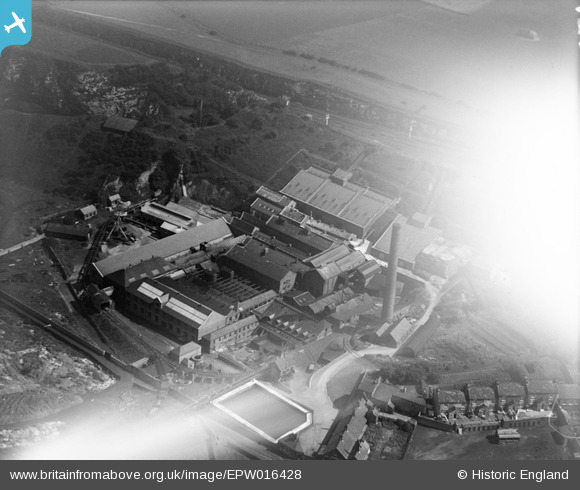
EPW016428 ENGLAND (1926). Ford Paper Mills, South Hylton, 1926
© Copyright OpenStreetMap contributors and licensed by the OpenStreetMap Foundation. 2024. Cartography is licensed as CC BY-SA.
Nearby Images (15)
EPW016428

EAW014473

EPW016427

EAW014479

EAW014474

EAW014478

EAW014472

EAW014470

EAW014475

EAW014476

EAW014471

EAW014469

EAW014477

EPW016434

EPW016432

Details
| Title | [EPW016428] Ford Paper Mills, South Hylton, 1926 |
| Reference | EPW016428 |
| Date | 29-July-1926 |
| Link | |
| Place name | SOUTH HYLTON |
| Parish | |
| District | |
| Country | ENGLAND |
| Easting / Northing | 436051, 557379 |
| Longitude / Latitude | -1.4376302266257, 54.90973723743 |
| National Grid Reference | NZ361574 |
Pins
Be the first to add a comment to this image!
User Comment Contributions
Closed possibly 1971 now just a big green field |
 Richard B |
Tuesday 26th of June 2012 08:14:46 AM |


