
EPW016301 ENGLAND (1926). Frodingham, Scunthorpe, from the north, 1926

© Copyright OpenStreetMap contributors and licensed by the OpenStreetMap Foundation. 2024. Cartography is licensed as CC BY-SA.
Details
| Title | [EPW016301] Frodingham, Scunthorpe, from the north, 1926 |
| Reference | EPW016301 |
| Date | 14-July-1926 |
| Link | |
| Place name | SCUNTHORPE |
| Parish | |
| District | |
| Country | ENGLAND |
| Easting / Northing | 489214, 412153 |
| Longitude / Latitude | -0.65176798937982, 53.598104864403 |
| National Grid Reference | SE892122 |
Pins
 Hamst |
Tuesday 18th of February 2020 10:43:49 AM | |
bradleyem |
Monday 16th of April 2018 03:00:45 PM | |
angus |
Sunday 30th of June 2013 04:15:42 PM | |
flyover |
Tuesday 22nd of January 2013 11:29:33 PM | |
flyover |
Tuesday 22nd of January 2013 11:29:04 PM | |
flyover |
Tuesday 22nd of January 2013 11:27:00 PM | |
flyover |
Tuesday 22nd of January 2013 11:26:40 PM |
User Comment Contributions
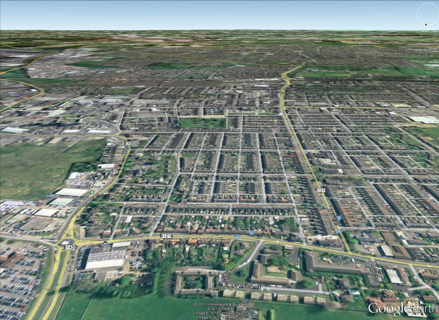 It is the village of Old Crosby in the foreground. The 2 roads snaking away are Normanby Road on the left, and Frodingham Road continuing to Ashby Road on the right. You can see the old Scunthorpe Cemetery in the centre of the picture and I think just part of the Old Showground on the middle of the right hand side. The Scunthorpe United football ground, as was. This area of Crosby and Scunthorpe was laid out on a grid-iron street pattern, with 'ten foots' running between them at the bottom of the gardens. In the upper left you can make out a similar pattern of streets,being the houses built by the Frodingham Ironmaster for the workers, known as Frodingham Village. Just to the right of those you can see more Ironworkers housing(slightly later) which is the area of New Brumby. |
flyover |
Tuesday 22nd of January 2013 09:09:31 PM |


