
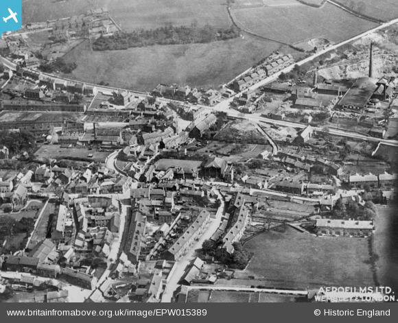
EPW015389 ENGLAND (1926). The town centre, Conisbrough, 1926. This image has been produced from a copy-negative.
© Copyright OpenStreetMap contributors and licensed by the OpenStreetMap Foundation. 2024. Cartography is licensed as CC BY-SA.
Nearby Images (5)
EPW015389

EPW012956

EPW014865

EPW014864

EPW014867

Details
| Title | [EPW015389] The town centre, Conisbrough, 1926. This image has been produced from a copy-negative. |
| Reference | EPW015389 |
| Date | 3-May-1926 |
| Link | |
| Place name | CONISBROUGH |
| Parish | |
| District | |
| Country | ENGLAND |
| Easting / Northing | 451320, 398493 |
| Longitude / Latitude | -1.2265972415944, 53.480402442499 |
| National Grid Reference | SK513985 |
Pins
 MB |
Friday 22nd of January 2021 01:49:39 PM |


