
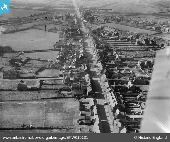
EPW015101 ENGLAND (1926). The High Street, Brownhills, 1926
© Copyright OpenStreetMap contributors and licensed by the OpenStreetMap Foundation. 2024. Cartography is licensed as CC BY-SA.
Nearby Images (6)
EPW015101

EPW060275

EPW060278

EPW060274

EPW015100

EPW060276

Details
| Title | [EPW015101] The High Street, Brownhills, 1926 |
| Reference | EPW015101 |
| Date | 12-April-1926 |
| Link | |
| Place name | BROWNHILLS |
| Parish | |
| District | |
| Country | ENGLAND |
| Easting / Northing | 404808, 305264 |
| Longitude / Latitude | -1.928931882226, 52.644743510591 |
| National Grid Reference | SK048053 |
Pins
 Isobel |
Sunday 21st of January 2024 03:52:02 PM | |
Griffin |
Thursday 11th of October 2018 08:37:11 PM | |
Griffin |
Thursday 11th of October 2018 08:30:39 PM | |
tissuehankie44 |
Friday 6th of June 2014 07:37:24 PM |


