
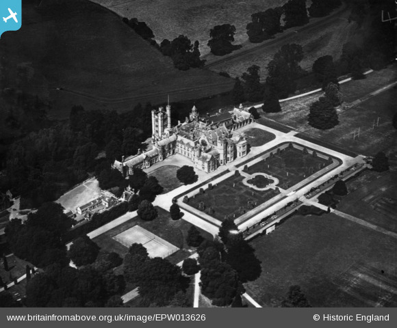
EPW013626 ENGLAND (1925). Canford School, Canford Magna, 1925. This image has been produced from a print.
© Copyright OpenStreetMap contributors and licensed by the OpenStreetMap Foundation. 2024. Cartography is licensed as CC BY-SA.
Nearby Images (5)
EPW013626

EPW013622

EAW024376

EAW024378

EAW003649

Details
| Title | [EPW013626] Canford School, Canford Magna, 1925. This image has been produced from a print. |
| Reference | EPW013626 |
| Date | June-1925 |
| Link | |
| Place name | CANFORD MAGNA |
| Parish | |
| District | |
| Country | ENGLAND |
| Easting / Northing | 403356, 98893 |
| Longitude / Latitude | -1.9523840425429, 50.789030775401 |
| National Grid Reference | SZ034989 |
Pins
Be the first to add a comment to this image!


